Panoramas of Kazakhstan & Kyrgyzstan
This time we have some panoramas for you from 2 countries, one of which is the 9th biggest in the world (Kazakhstan). We spent a total of 6 weeks here, about 3 in each.
The 2 nations are very different, and even within one country the scenery changes with every few hundred kilometers, making it fascinating areas to explore. As usual, our route changed as soon as we got there and started reading about the many interesting places we could go to.
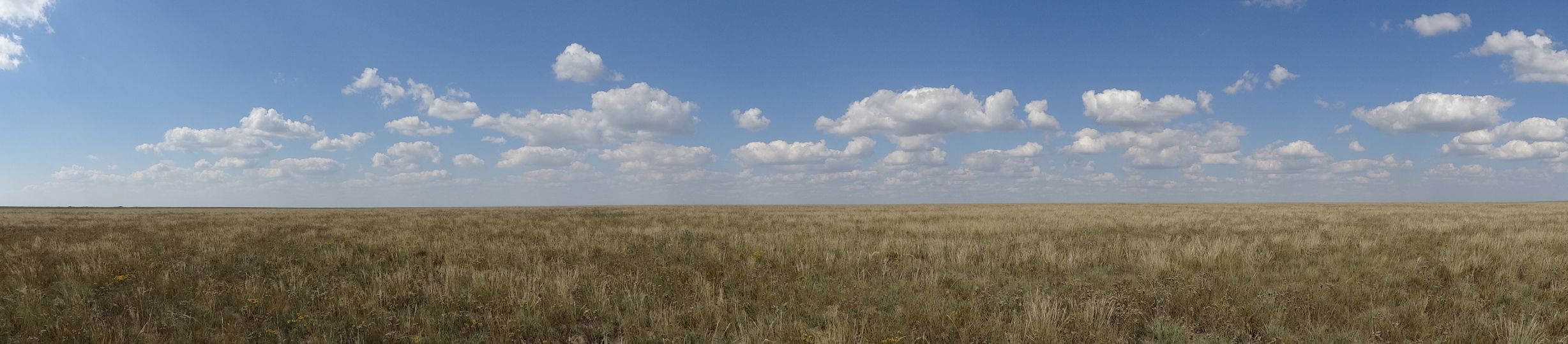
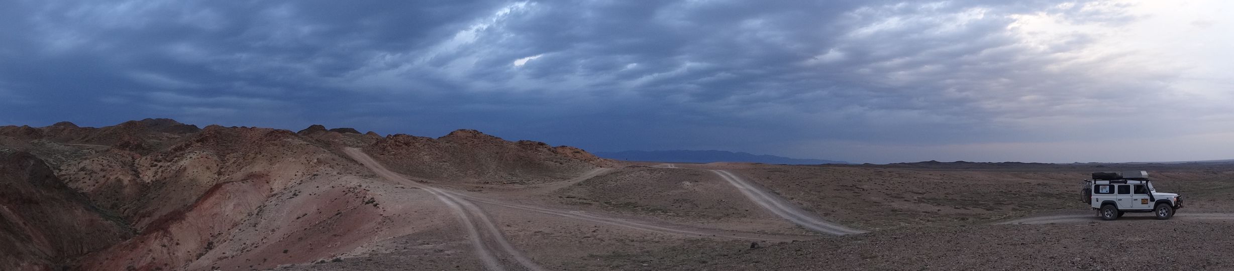
Kazakhstan – Qorghalin
The vastness of the Kazakh steppe in the north, some might think it boring country, we thought the emptiness mesmerizing.
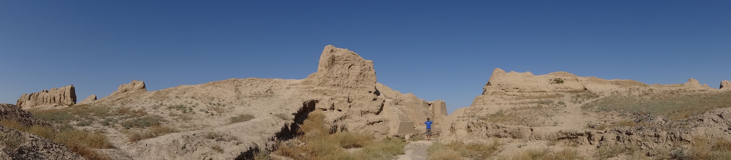
Kazakhstan – Sauran
First glimpses of the famous Silk Road, an ancient adobe caravan-serai. After 3 days driving to get here, we felt as happy arriving here as travelers must have been back in those days.

Kazakhstan – Sauran
We stayed overnight inside the old carava-serai and were rewarded with a stunning sunset.

Kazakhstan – Aksu-Zabagyly National Park
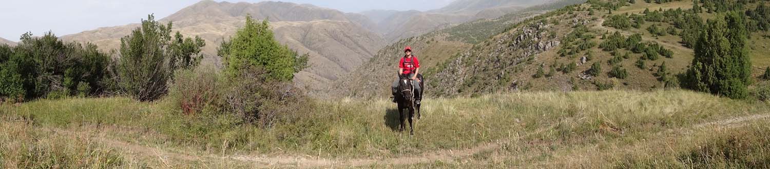
Kazakhstan – Aksu-Zabagyly National Park
Horseriding through the mountains of this stunning national park was rewarded with some seriously sore bums (and amazing views).
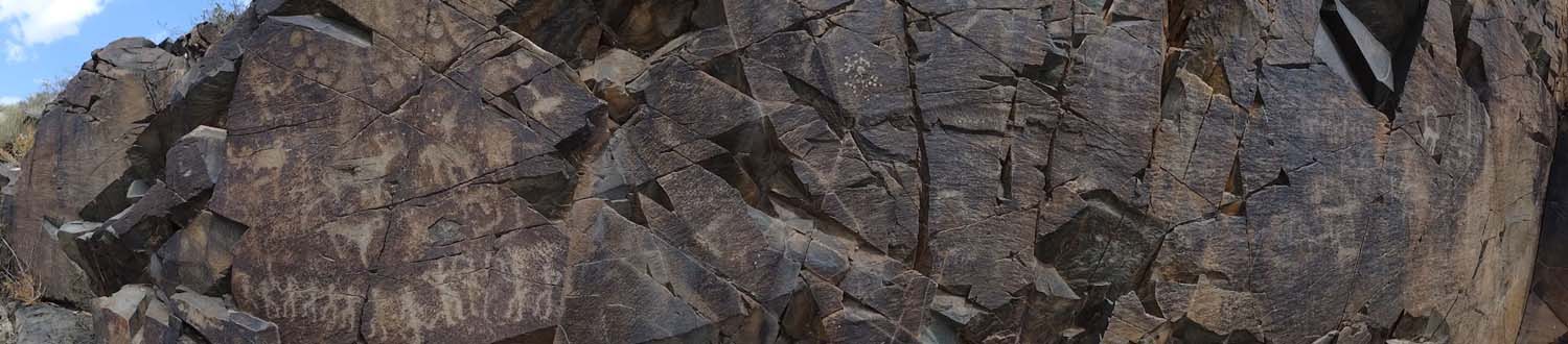
Kazakhstan – Tamgaly petroglyphs
We add another world heritage site from Unesco to our list when we visit the Tamgaly petroglyphs. More than 3000 petroglyphs from the bronze and early stone age can be found here, as well as burial mounds, graves and remains of settlements. You can see a party on the left, and just to the right of the middle you can see some sun gods.
Kazakhstan – Charyn Canyon
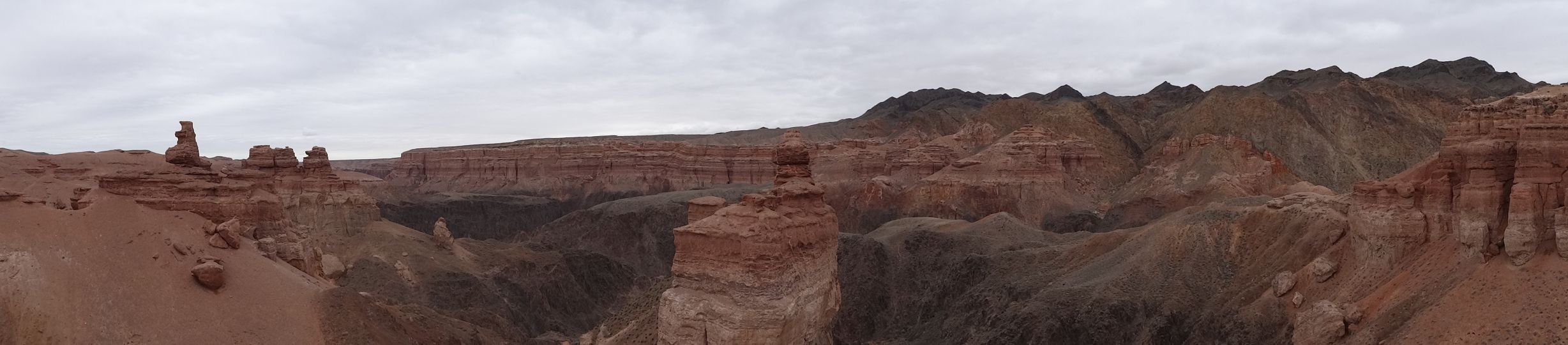
Kazakhstan – Charyn Canyon
The stunning, red rocks of the Charyn Canyon make it very impressive. We were treated to some serious gale force winds during our overnight stay, making us a little grumpy the next day due to lack of sleep.

Kazakhstan – Charyn Canyon
A little further the Charyn Canyon creates little oases along its icy waters, the contrast stunning (we think).
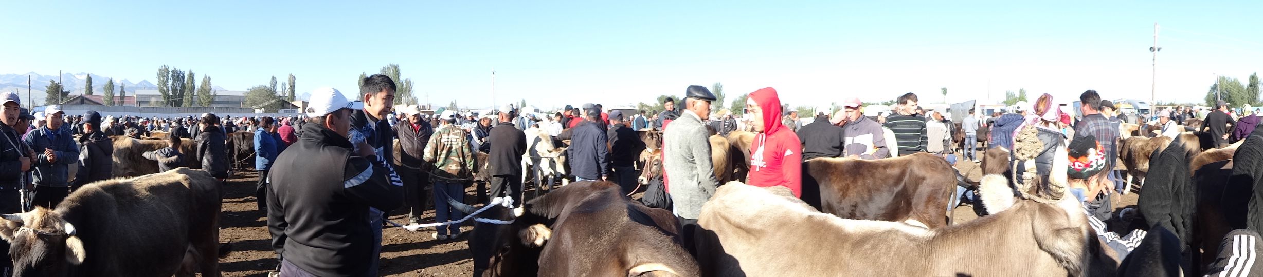
Kyrgyzstan – Karakol
Every Sunday the locals gather to sell or buy livestock at this huge animal market. No reading descriptions, no checking out a photo, no entering of credit card details and no clicks with a mouse. Here they hand over real cash to buy their next sheep or walking hamburger after a bit of prodding, lifting, squeezing and serious negotiations about the price.
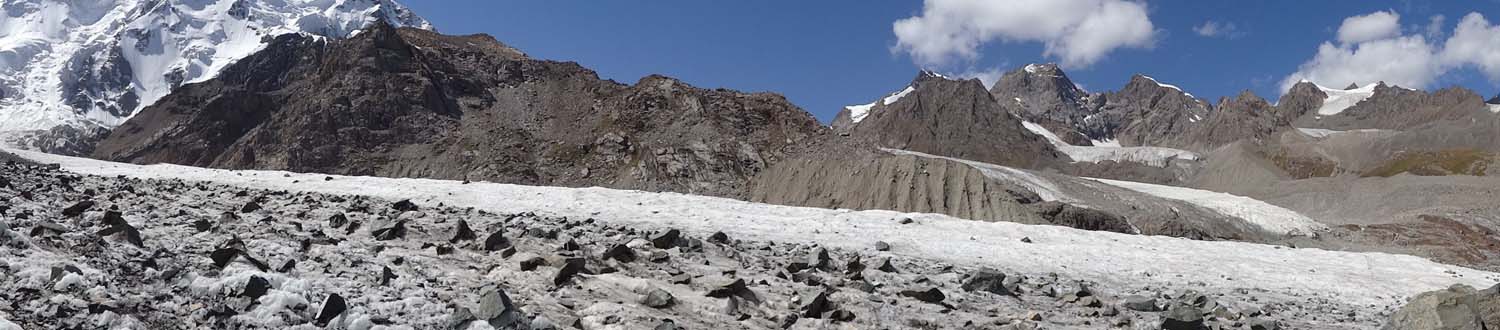
Kyrgyzstan – Karakol Glacier (gletsjer)
The Tian Shan mountains of Kyrgyzstan provide plenty of opportunities to snap panoramas, it was hard to pick ‘the best ones’. This was the glacier at the top of the Uch Tor valley.
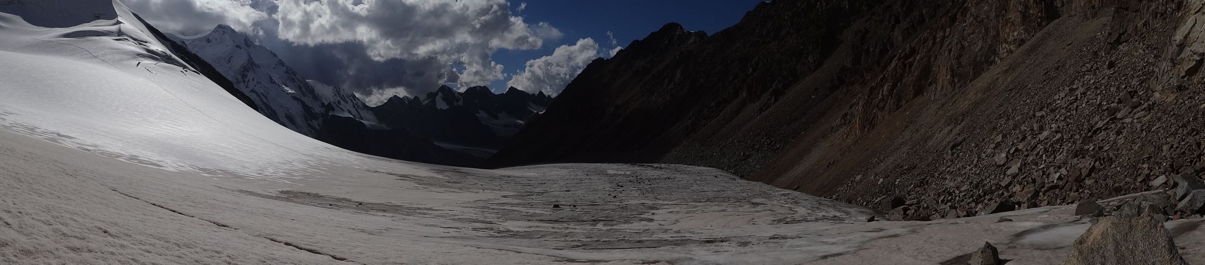
Kyrgyzstan – Karakol Glacier
The view from (near) the top of the glacier, looking back down the Uch Tor valley.

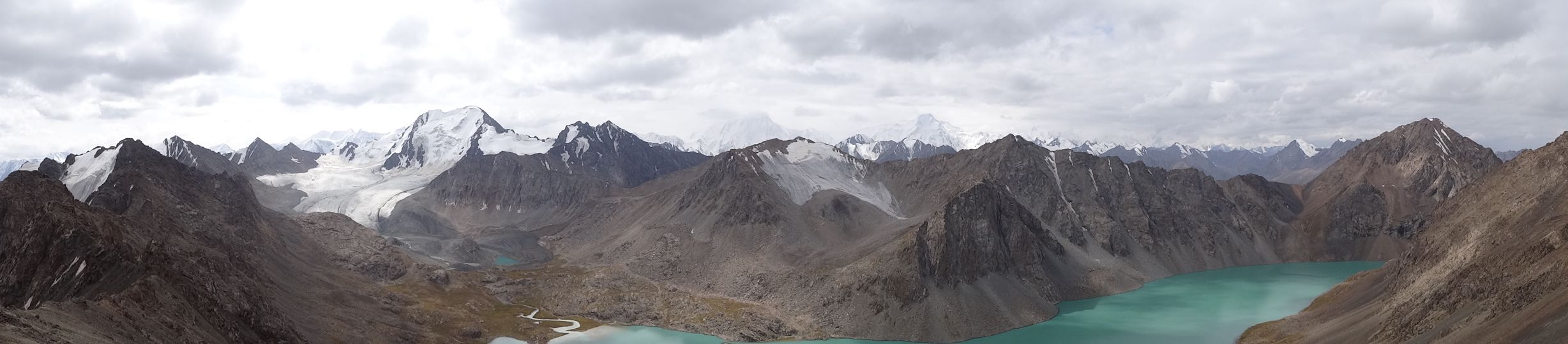
Kyrgyzstan – Kul Tor Valley
Looking back up the Kul Tor Valley on the second day of our hike. We descended from the right, and the Karakol Glacier is on the other side of the snowcapped mountains, which we reached via the 4020m pass.

Kyrgyzstan – Karakol hike
The final scree slope before we get to the beautiful blue Ala Kol lake for our campsite on day 4 of our hike. The waterfall comes straight from the lake.

Kyrgyzstan – Karakol hike
The last day of the hike, on the final ascent up to the Ala Kol pass (directly above Jude’s head) where it was snowing. Then a long way down to the hot springs in the next valley.
Kyrgyzstan – Karakol hike
View from the Ala Kol pass at 3860m. Just stunning isn’t it?

Kyrgyzstan – Lake Issy Kul
A wind-still evening on the shores of Lake Issy Kul with a gorgeous sunset. We had a swim and enjoyed reading our books until the natural light disappeared.
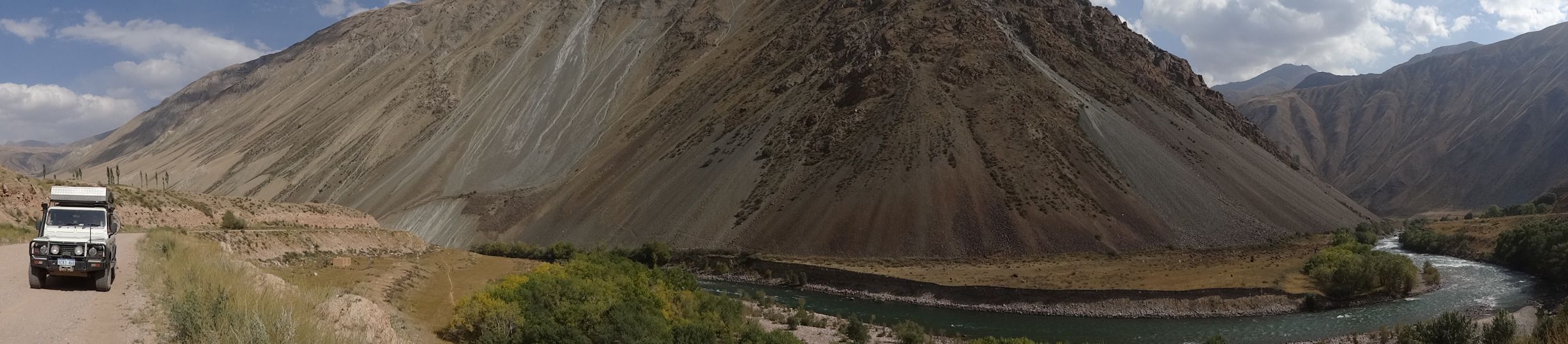
Kyrgyzstan – Kokomoron River valley
On our way to Lake Song-Kol through another beautiful valley. The road followed the glacial river for dozens of kilometers. A little earlier we had met the hardcore Russian rafters paddling this grade 5 / 6 river.

Kyrgyzstan
A deserted track next to a little creek makes another perfect campsite. We haven’t had any problems finding great campsites in both Kazakhstan and Kyrgyzstan. Our standards have definitely improved since China!
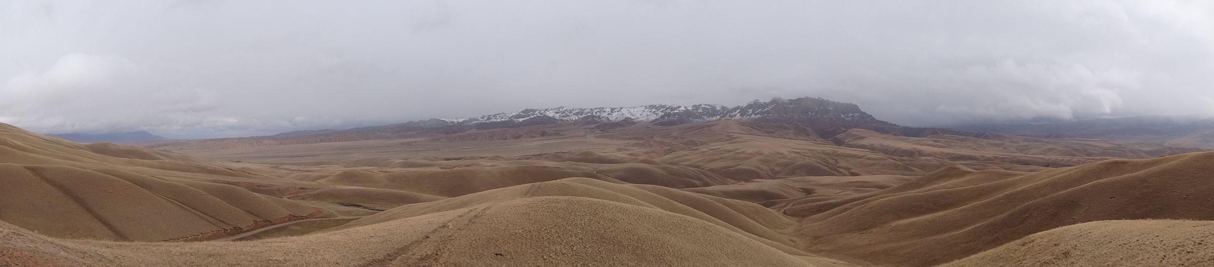
Kyrgyzstan
Driving from Tash Rabat (the historic caravan-serai) to Arslanbob (the biggest walnut forest in the world) we drove through this type of landscape for 2 days. The snow on top of the mountains is fresh. On the higher passes we had to plough through 10 cm of fresh snow.

Kyrgyzstan
Another issue caused by the terrible Mongolian roads or is it too late to blame those now? The back brake protection plate cracked and had to be removed. We had it welded in Osh a couple of days later for $5. This was the only rainy day during our 6 weeks in Kazakhstan and Kyrgyzstan.
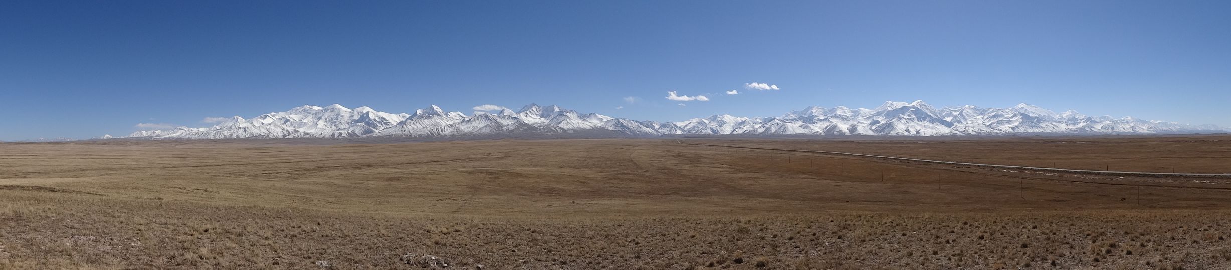
Kyrgyzstan – the Pamirs
Our first view of the Pamir mountains as we approach the border with Tajikistan. Peak Lenin at 7,150m is visible towards the right, and the Pamir Highway cuts through the middle of the chain. This was one of the most magnificent views of the trip so far.
Fantastic pics! Can’t wait to see them ALL! 😉
hahaha, you’d probably need weeks to see them all!
How did you get the panoramic shots? Did you take them like this or crop them wide afterwards? Great landscape photographs! x
thanks! we take the panos using our little Sony compact camera, works great and we use it all the time.
Stunning photographs! Esp the Ala Kol pass x
thanks Claire, glad you enjoyed them. More stories and photos coming soon (uploading some tonight hopefully).